Posts focused on Data Management Systems and MEL
Page 4

Data Visualization for Development Planning at European Development Days
The 7th edition of the European Development Days (EDDs) took place in Brussels, Belgium, in October 2012. Organised by the European Commission, the EDDs is the main forum on international affairs and development cooperation in Europe. The forum serves as a veritable melting pot of development advocates, decision-makers and practitioners, bringing together some 6,000 people and 1,500 organisations annually to learn from each other’s best practices, discuss and network.
Interactive Dashboard Shows Aid Trends in Africa
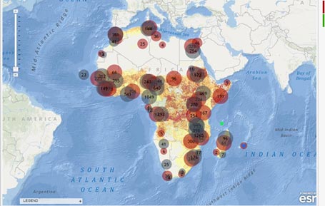
The Strauss Center's Climate Change and African Political Stability (CCAPS) program has released a new aid dashboard that includes an interactive map and graphing tools, allowing users to explore trends in aid allocation by donor, sector, and demographics across Africa. The dashboard is a collaborative effort that includes geocoded aid data from CCAPS and several partner institutions. AidData and CCAPS built the aid dashboard using Esri tools to combine trends analysis with the most comprehensive collection of geocoded data on aid projects in Africa.
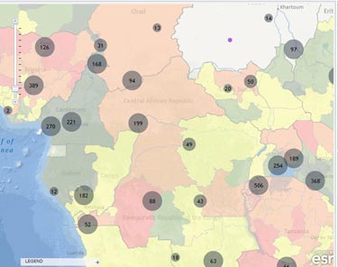
New Geocoded Data Sheds Light on Social Conflict
The Climate Change and African Political Stability (CCAPS) program launched Version 2.0 of the CCAPS mapping tool this week, adding the full Social Conflict in Africa Database, and updating the Armed Conflict Location and Event Dataset (ACLED) with events through 2012.
Mapping Tool Analyzes How Climate Change, Conflict, and Aid Intersect
PRESS RELEASE
Geocoding Hits the Ground
'This Story from the Field comes from Joshua Powell, a Business Development Associate with Development Gateway focusing on AidData and geocoding work:'

Open Data, Open Knowledge, Open Solutions: Possibilities and Pitfalls’
A panel discussion on “Open Data, Open Knowledge, Open Solutions,” hosted by the World Bank Institute on September 22, served as a platform for participants to discuss the multifaceted dimensions of open data in international development. It focused on global interconnectedness, free information flows, new technologies, and greater openness. Panelists explored different avenues to further empower individuals and to create new solutions to global development challenges.
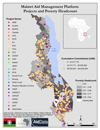
AfDB and AidData geocode aid projects
The African Development Bank (AfDB) and AidData recently released a data set containing the sub-national locations of all AfDB projects continent-wide approved from 2009-2010. The data, available at Open.AidData, represent more than $10 billion in AfDB Group funding to 43 African countries.
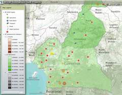
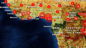
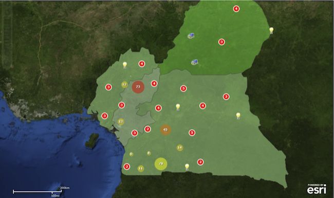
Where does aid go? Mapping the African Development Bank’s Activities
Last week, the African Development Bank (AfDB) and AidData launched an interactive map showing the precise locations of the AfDB’s ongoing operations in Cameroon, Morocco, and Tanzania.