Development Gateway launches the Open Aid Geocoder
Development Gateway is proud to announce the launch of the Open Aid Geocoder, a new open-source geocoding tool developed in partnership with the World Bank’s Open Aid Partnership. The Open Aid Geocoder works in tandem with aid and project information management systems to assign precise geospatial data on the locations of development projects. The Open Aid Geocoder has been built using the latest innovative technologies, such as React and Reflux, mixed with other popular libraries such as Leaflet, i18next and Bootstrap, compiled together using Webpack, and can be integrated with all standard and custom-built aid information and project management systems via a small set of API endpoints.
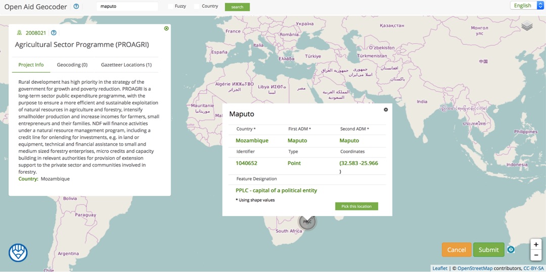
The Open Aid Geocoder utilizes the geocoding fields of the International Aid Transparency Initiative data schema for geocoding, ensuring that data is comparable across countries and development partners. Geographic information is stored in GeoJson format, the premier open standard format used for storing geographic data, facilitating easy integration with various internal systems. The tool itself is licensed under an Apache 2.0 open source license. By focusing on international standards and open source software, Development Gateway continues to play a leading role in contributing to a growing community of practitioners that are striving to make better decisions about resource allocation using geospatial data.
If you are interested in using the Open Aid Geocoder, please visit our GitHub repository and the wiki for the project, or contact vgoas@developmentgateway.org for more details.
Share This Post
Related from our library

A Year After USAID: Reclaiming Control of Data Systems
Just months after the 2025 U.S. aid freeze was announced, we published a blog post warning that the USAID cuts would result in a data crisis, with some countries losing access to their digital health data. This blog explores how those systems – and the countries relying on them – have fared nearly a year on.

Data on Youth and Tobacco in Africa Program Enters Phase II
The Data on Youth and Tobacco in Africa (DaYTA) program is launching its second phase, expanding to five additional countries. This blog highlights DaYTA’s objectives, innovative approach, and the key activities driving impact in adolescent tobacco control measures.

Introducing The HackCorruption Civic Tech Tools Repository
Introducing the Civic Tech Tools Repository: an open-source hub of digital solutions to fight corruption. Designed for growth through GitHub contributions, it brings together tools, code, and resources across six key areas for HackCorruption teams and beyond.