Posts categorized Open Data
Page 15
How Can We Make Open Data Meaningful to Citizens?
I am Owen Scott and recently I was fortunate enough to have the opportunity to attend the Engineers Without Borders Canada (EWB Canada) National Conference in Calgary. EWB Canada - no affiliation with EWB USA - is a progressive development organization focused on creating transformative change in African markets, public sectors, and civil society through supporting a continuously evolving portfolio of innovative ideas and ventures.
The Aid Management Journey to Transparency and Open Data
The open data and transparency revolution underway in international development is as much about culture change as it is about data, technology, and standards. I am Nancy Choi, Director of Operations, and recently I have been in the midst of these changes.

4 Ways to Bring Sexy Back to the US Government’s Open Data Strategy
The US Office of Management and Budget (OMB) recently released its Guidance on Collection of U.S. Foreign Assistance Data prompting well-deserved praise from the Center for Global Development in Hooray for Unsexy OMB Data Guidance.
The Open Data Effect: Creating Optimistic Radicals at OKFest’
I am Stephen Davenport, Director of Innovation at Development Gateway, and recently I attended my first Open Knowledge event, the OKFestival in Helsinki Finland. As a development professional with a technology background I am often skeptical of such events as too soft a subject. What is knowledge anyway? It’s too generic. It’s too easy to immerse yourself in the theoretical and loose sight of the practical.
Open Data, Open Knowledge, Open Solutions: Possibilities and Pitfalls’
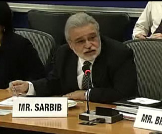
A panel discussion on “Open Data, Open Knowledge, Open Solutions,” hosted by the World Bank Institute on September 22, served as a platform for participants to discuss the multifaceted dimensions of open data in international development. It focused on global interconnectedness, free information flows, new technologies, and greater openness. Panelists explored different avenues to further empower individuals and to create new solutions to global development challenges.
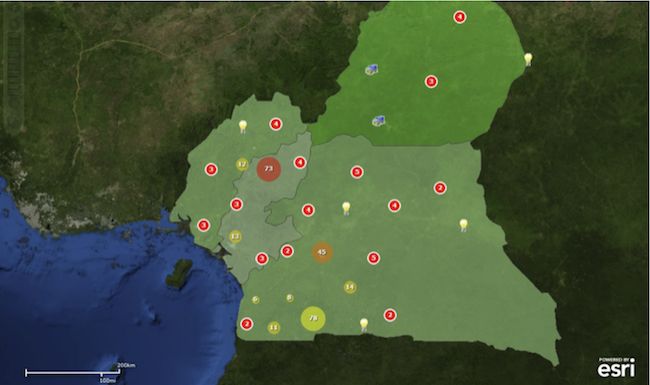
AfDB and AidData geocode aid projects
The African Development Bank (AfDB) and AidData recently released a data set containing the sub-national locations of all AfDB projects continent-wide approved from 2009-2010. The data, available at Open.AidData, represent more than $10 billion in AfDB Group funding to 43 African countries.
DG at the Open Data for Development Camp
This Story from the Field comes from Anna Lauridsen of Development Gateway International. She tells us about her participation in the Open Data for Development Camp held in Amsterdam in May: The Open Data for Development Camp was put together by Open for Change, a network based in the Netherlands committed to transparency, collaboration and impact in development, on request by the Dutch Foreign Ministry. I was there to present the geocoding work that Development Gateway and the AidData team have done. At the heart…
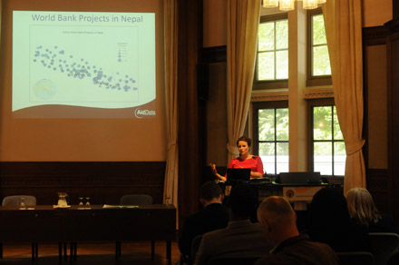
Open Data for Development Camp highlights challenges and innovations in aid transparency
The Open Data for Development Camp (ODDC), hosted by Open for Change in Amsterdam from May 12-13, proved to be a fantastic forum for discussion of practical issues in institutionalizing open data practices. Participants generally agreed that open development data should be a core component of a paradigm shift towards increased transparency, accountability, and public participation in development practice.
African Development Bank and AidData map development projects: Increasing aid transparency for greater development impact’
PRESS RELEASE Lisbon and Washington, DC—June 9, 2011— At its Annual Meetings, being held from June 9-10 in Lisbon, the African Development Bank Group unveiled an interactive map showing the precise locations of its ongoing operations in Cameroon, Morocco, and Tanzania (http://184.73.156.57/afdbprojects/). These countries represent a subset of the 2,040 activities financed across the continent since 2009. The map is the result of a partnership between the African Development Bank (AfDB) and AidData (www.aiddata.org) to geocode AfDB projects, which range from building primary schools, health…
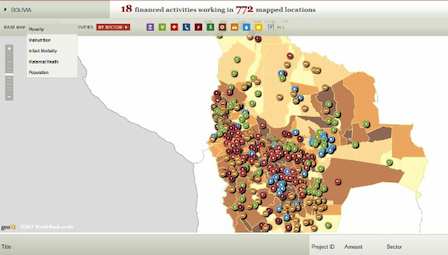
World Bank and AidData put aid information on the map
PRESS RELEASE