Posts focused on Data Management Systems and MEL
Page 2
Announcing AD3: Administrative Data-Driven Decisions
Development Gateway (DG) is proud to launch the Administrative Data-Driven Decisions (AD3) program, supported by the William and Flora Hewlett Foundation. Through this program, DG will work with governments in East and West Africa to improve the efficiency, effectiveness, and use of administrative data systems.
Mapping for the Fight Against HIV/AIDS in Côte d’Ivoire: Our Continued Adventure
Geography and accessibility to services hold significant weight in identifying comprehensive strategies to sustainably control the HIV/AIDS epidemic. The Open Geospatial Data Center for Health (OpenDCH) project, supported by PEPFAR, aims to advance analysis of where the most affected communities are located, to focus on closing gaps in HIV testing and treatment. It will serve to improve understanding of HIV program coverage at the community level — leading to improved adherence, retention, and targeting of services.
Challenging Assumptions: Lessons from Designing User-Centric Tools in Malawi
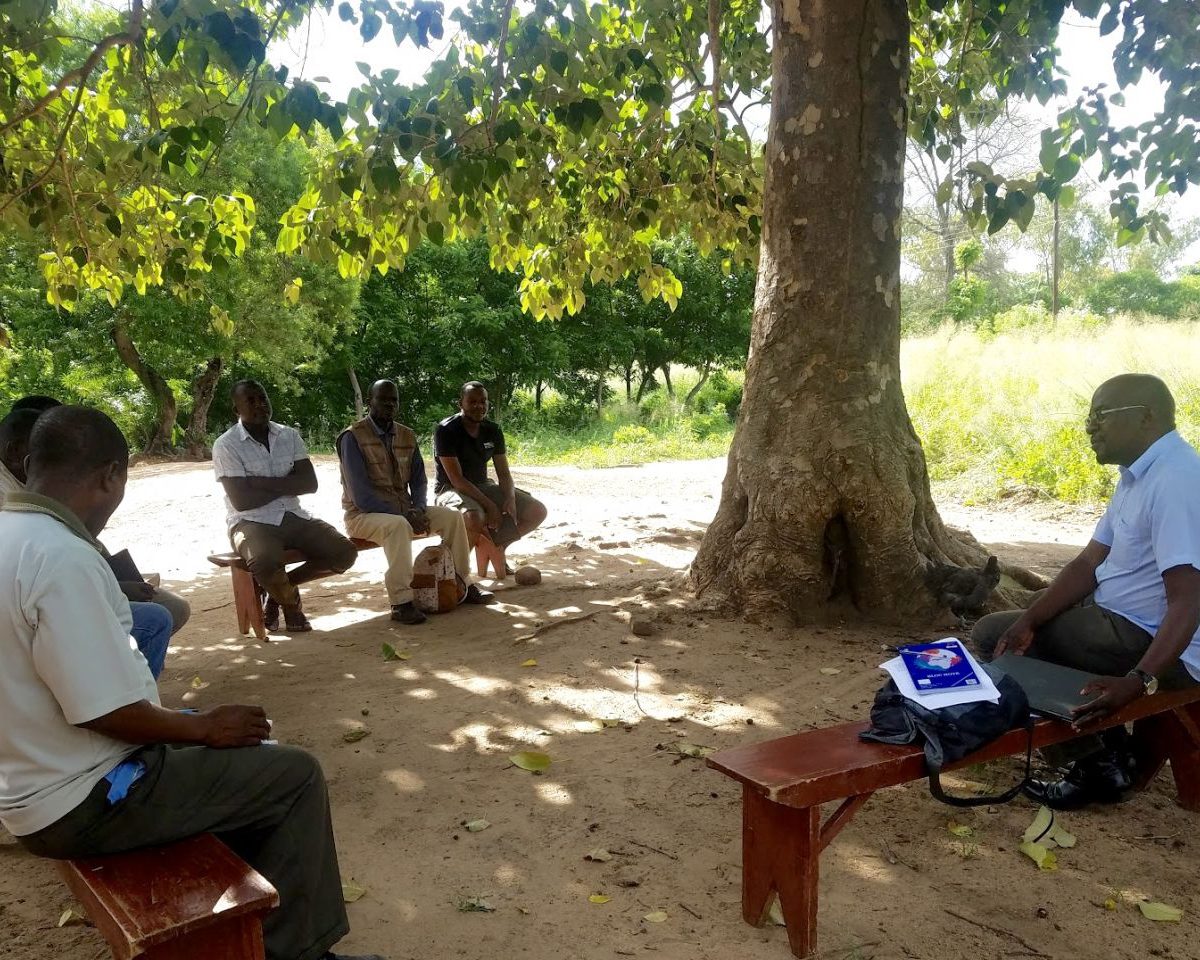
What does it take to design a platform to collect, manage, and analyze a country’s agricultural information? Ideally, a significant amount of time to speak with key data producers and intended data users to understand needs and achieve buy-in. But, as was our experience in Malawi, – it also requires a fair amount of humility and iteration.
Security and Privacy in a Data-Driven World
The 2018 Spring Meetings of the International Monetary Fund (IMF) and the World Bank Group (WBG) took place amidst a striking moment in the news – one that has brought data, especially data privacy, into the spotlight. As we transition to the EU General Data Protection Regulation, privacy and data security issues are a priority
Employing PDIA to Improve Agriculture Admin Data Systems in Malawi
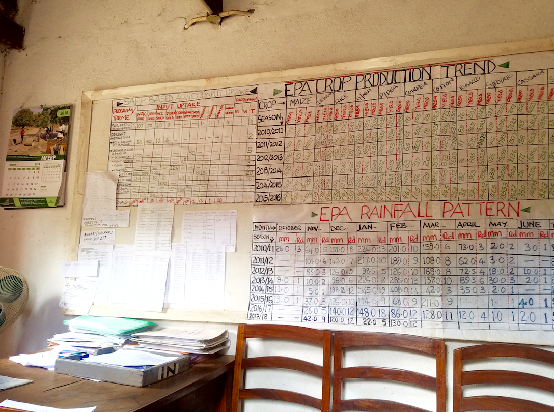
Agriculture data being reported, collected, and visualized is growing exponentially. But are the data we’re spending so much to collect truly relevant for decision makers? We’re proud to announce that, through our Results Data Initiative (RDI), we’re working with Malawi’s Ministry of Agriculture, Irrigation and Water Development (MOAIWD) to design a National Agriculture Management Information System (NAMIS).
On the Money: Getting Funding for Data Right
Last week, we shared our schedule for this week’s Data for Development Festival, hosted by the Global Partnership for Sustainable Development Data (GPSDD) in Bristol, UK. The event brings together a vibrant community of governments, foundations, private sector and nonprofit organizations, galvanized by the belief that data, used well, can drive better development outcomes and
.jpg)
Joining Up Data to Combat HIV/AIDS in Côte d’Ivoire
How can “joined-up” geospatial data support the battle against HIV/AIDS, by promoting evidence-based decision-making? Last month, Development Gateway joined our partners at the AidData Center for Development Policy in launching the Côte d’Ivoire (CIV) open geospatial data center (OpenDCH), supported by USAID-CIV and PEPFAR. The OpenDCH/GeoCenter aims to address key challenges related to the country’s
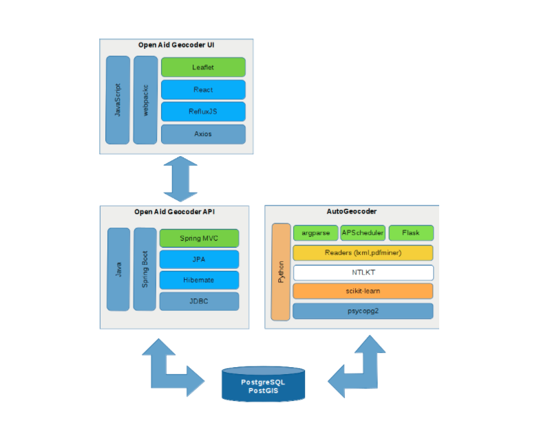
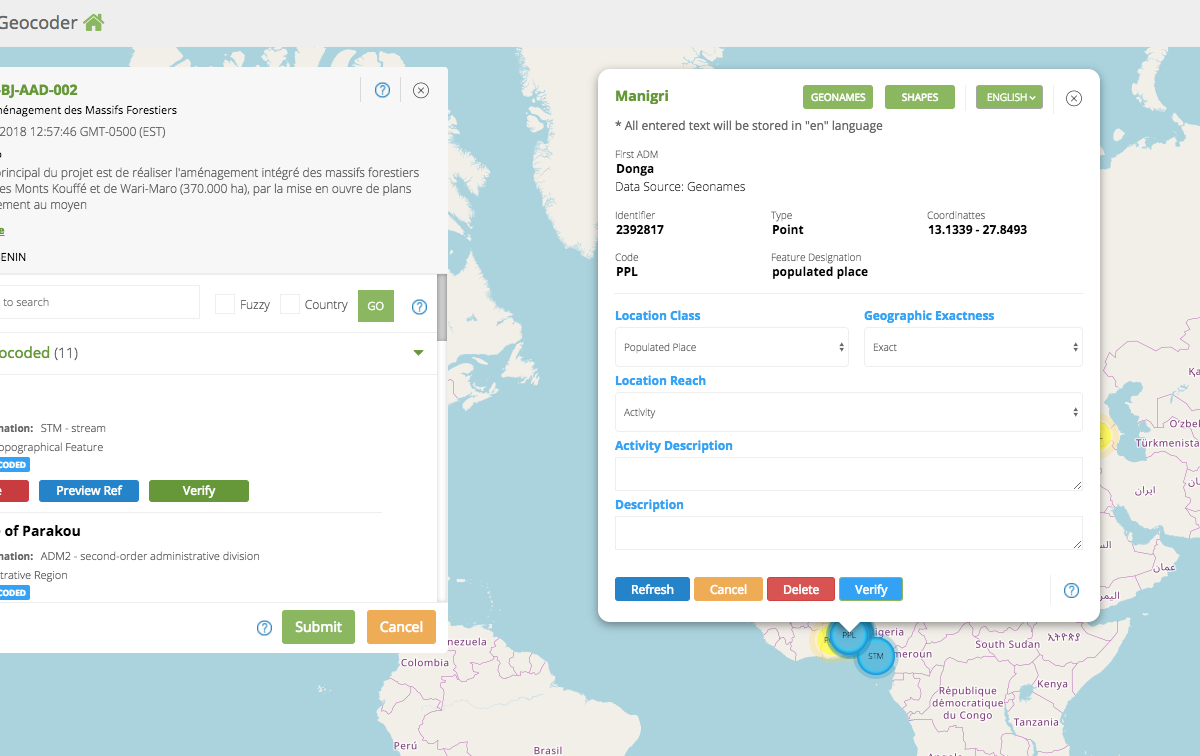
The Geocoding Suite: Let’s Get Technical
Development Gateway’s Geocoding Suite has several components, each working in tandem with aid and management information systems to assign precise geospatial data on the locations of development projects.We have recently announced the addition of a lightweight, user-friendly automatic geocoding backend tool – aptly called the AutoGeocoder. If you read our last blog post, you’re familiar
Hey Alexa, Where is FAO Working in Uganda?
Okay, so we might not be able to ask our smart home systems questions about where development efforts are taking place just yet. However, we're working to determine whether we could use Machine Learning to help us more quickly answer that very question, “Where is FAO working in Uganda?”
Conceptualizing Self-Sufficiency for Aid Recipient Countries
Individual countries and large international organizations provide aid to low- and middle-income countries for a host of reasons, including to encourage economic growth, to support regional political stability, to expand market access and humanitarian purposes.